

Agrohub
Corporate site for the farm-to-hypermarket brand
Full case studyWebsiteUI/UX

Land-plot selection for the Lisi development, where the map is the interface and the plot is the product.
Visit orientiri.geFor Orientiri Lisi we designed and built a land-plot sales website with an interactive plot map at its centre. Buyers see all twenty-four plots of the gated neighbourhood by Lisi Lake in Tbilisi on an aerial view of the site, marked available, sold or reserved, and click a free plot for its area, its cadastral code and a price in dollars or lari, with a call request one step away. Around the map sit the project, the location, its advantages, answers to common questions, construction news and a gallery, in Georgian and English.
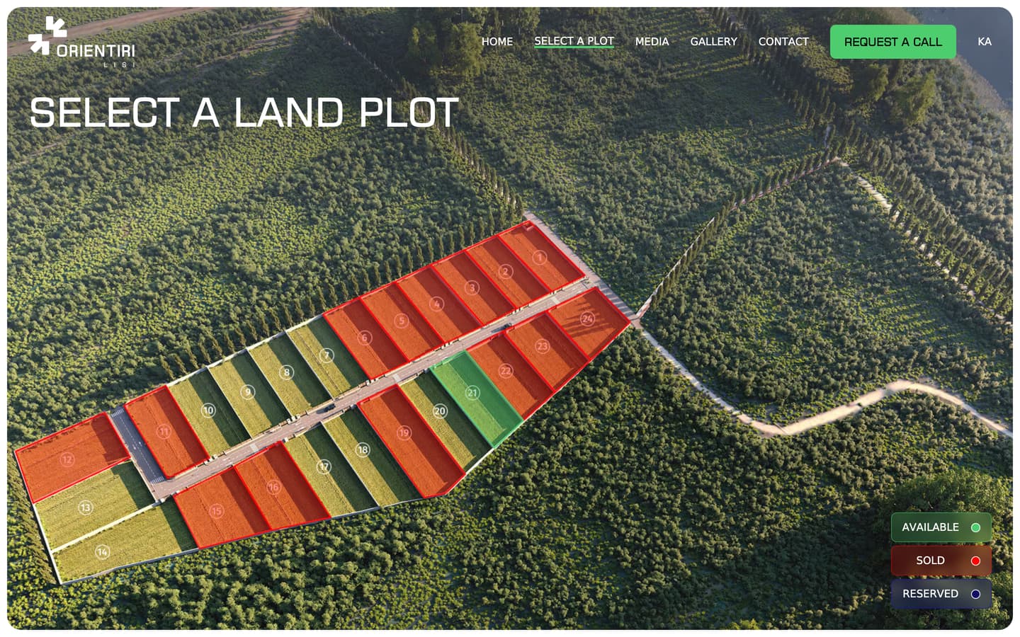
Every plot is outlined on an aerial view of the site. Free plots light up green under the pointer and sold ones show in red.
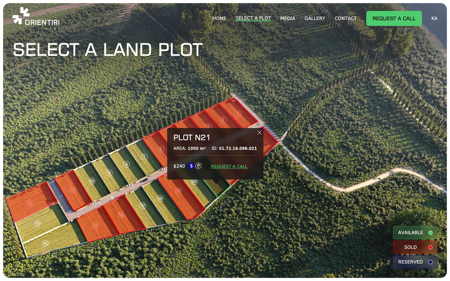
Click a free plot for its number, area and cadastral code, and a price that switches between dollars and lari.
The card's own link opens the call form, the same short form that the header offers on every page.
The home page sets out the location, the infrastructure and the fencing, answers buyers' questions and offers the presentation to download.
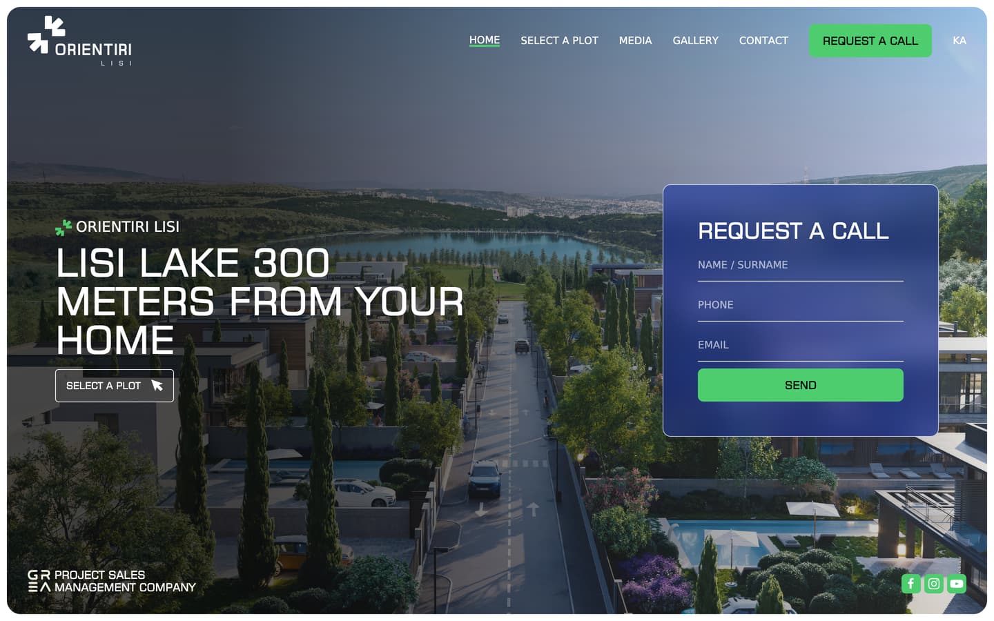
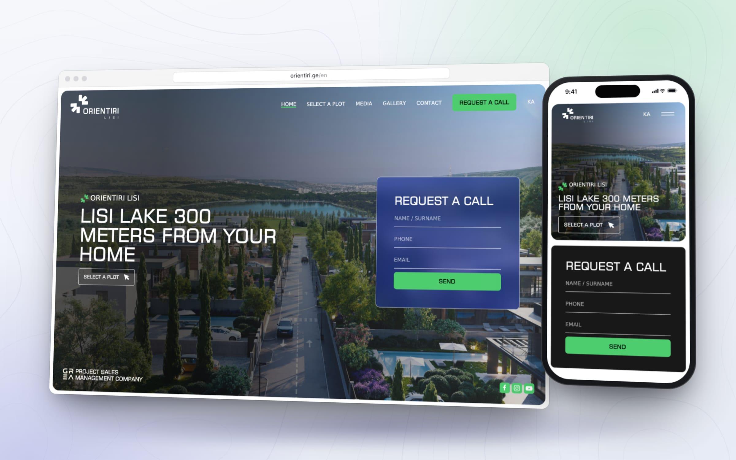
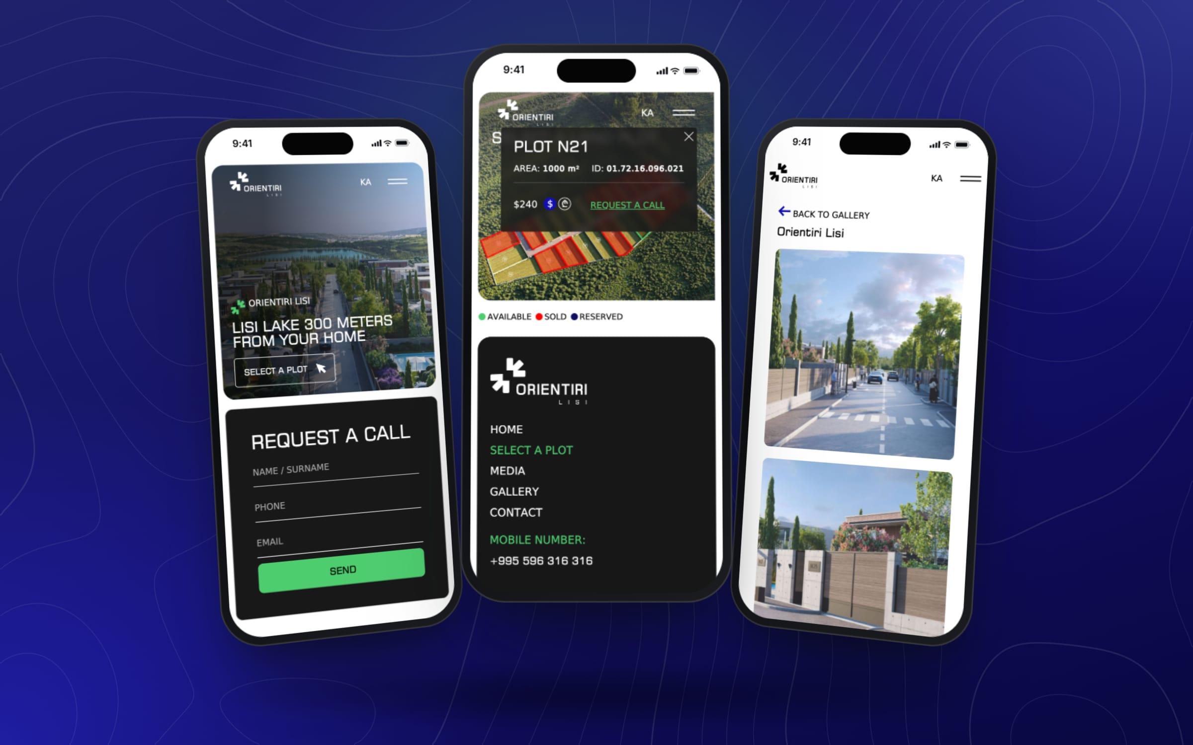
The site opens on a render of the street running down to Lisi Lake, under a headline that puts the lake 300 metres from your home. One button leads to the plot map, and a call request form sits beside it.
All twenty-four plots sit on one aerial view, the sold ones in red. Plot N21 is free, and it lights up green under the pointer.
A click opens the plot card: N21, 1,000 square metres, its cadastral code and a price in dollars, with a switch to lari and a link to request a call.
The link opens the call request over the dimmed map: a name, a phone number and an email, and one green button to send them.
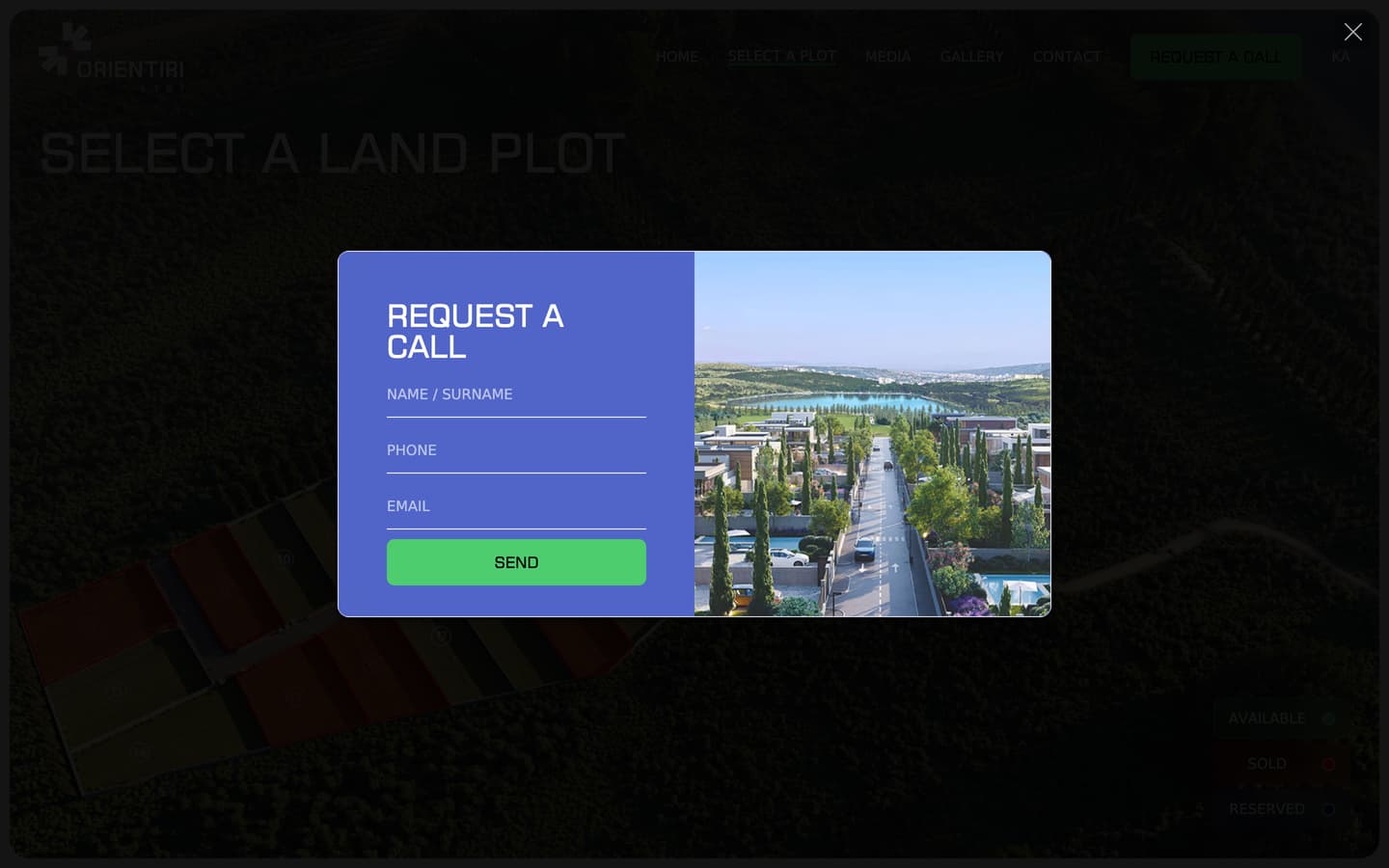

Free plots light up green under the pointer and sold ones show in red. Click a free plot and its card opens with the area, the cadastral code and a price that switches from dollars to lari.
Recorded on the live site
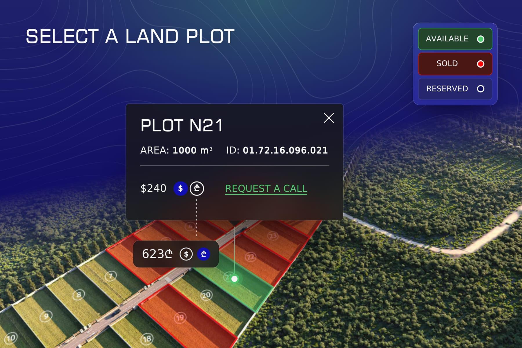
Plot N21: 1,000 square metres, cadastral code 01.72.16.096.021, a price in dollars or lari and a link to request a call. The legend tells available, sold and reserved plots apart.

A slider sets out the five advantages, from the location by Lisi Lake and the infrastructure to the fencing, the secured entry and the paved road. Below it, buyers' questions open in place: what the price includes, when the works finish and whether there is a fence.
Recorded on the live site

The green link on a plot card opens the call request, the same short form as the header button on every page: a name, a phone number and an email.

On a phone the plots and their cards work by tap, and the legend moves under the map. Switch one plot to lari and the next plot opens in lari too.
Recorded on the live site
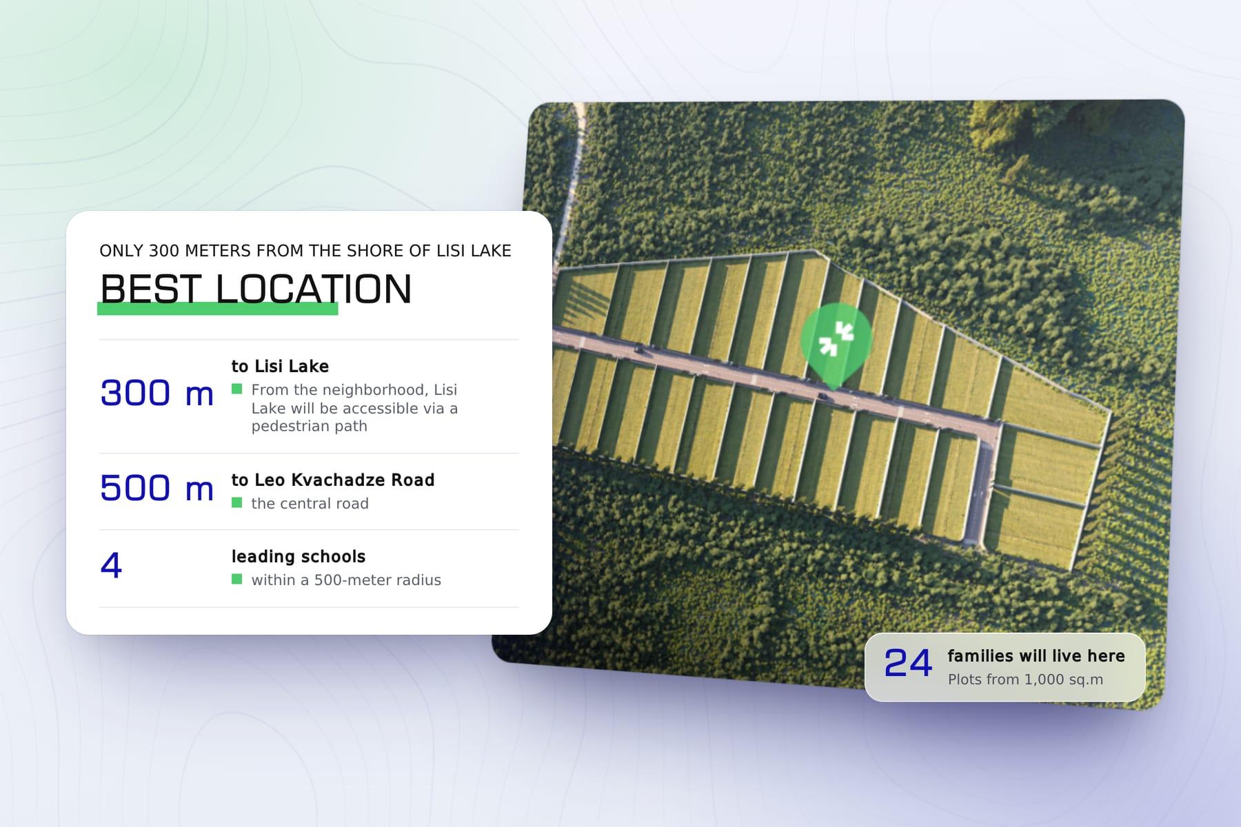
The home page sets out the location in figures: 300 metres from the shore of Lisi Lake, 500 metres from Leo Kvachadze Street and four leading schools within 500 metres. A footpath will lead from the neighbourhood to the lake.
Orientiri Lisi is a gated neighbourhood of private-house plots near Lisi Lake in Tbilisi, built by GRG and sold by GREA. Each plot comes with a fence, a gate and every utility brought to its boundary.
Buyers choose a plot by where it sits, so the site had to show the whole development at once, including what is still free.
We designed and built the site around its plot map, in Georgian and English. 'Select a plot' shows the development on an aerial view, with sold plots tinted red and a legend for available, sold and reserved; clicking a free plot shows its number, area, cadastral code and price in dollars or lari, with a link to request a call.
Around the map sit the project story, the location and its advantages, answers to common questions, a downloadable presentation and a gallery. A media section carries construction updates and offers, and the header of every page opens a call-back form.
Read from the live site: the build, the tags in its pages, and the services a visitor meets on them.
Planning something similar? The intro call is thirty minutes and commits you to nothing.
The 'Select a plot' page shows the whole neighbourhood on an aerial view, with the twenty-four plots numbered and coloured by status. A free plot lights up green under the pointer, and a click opens its card with the plot number, the area, the cadastral code, a price in dollars or lari and a link to request a call. Sold plots are tinted red and do not open a card.
Yes. Every plot on the map carries its status, and a legend explains the colours: available, sold or reserved. When we captured the map in November 2026, ten of the twenty-four plots were free and fourteen were sold.
Both. Each plot card shows a price in dollars with a lari circle beside it, and one click or tap switches the figure to lari. The card also gives the plot's area and its cadastral code.
A 'Request a call' button in the header of every page opens a short form for a name, a phone number and an email. The same form sits in the home page hero, the link on each plot card opens it, and the contact page has a longer form with room for a message.
The home page tells the story of the project, sets out the location and five advantages, among them the utilities brought to every plot and the unified fencing, answers buyers' questions and offers the project presentation to download. A media section carries construction updates and offers, and the gallery holds an album of renders that open in a lightbox.
Georgian, which is the default, and English. A language switch in the header reads EN on the Georgian pages and KA on the English ones, and the plot map, the plot cards and the call request forms work in both languages.
Vebses, a web studio in Tbilisi. We designed and built the site, from the plot map and its cards to the call request forms, the media section and the gallery. The neighbourhood itself is built by GRG and sold by GREA.
Yes, for a development sold plot by plot, using the same parts: an aerial map where every plot shows its status, a card with the area, the cadastral code and the price, a call request from the plot and from every page, and the project, the location and the answers around it. The plots, the renders and the content would belong to the new development.
Thirty minutes, no pitch deck. Describe the problem and we will tell you what it takes to solve it (scope, budget range, timeline), even if the answer is that you do not need us.